
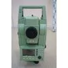
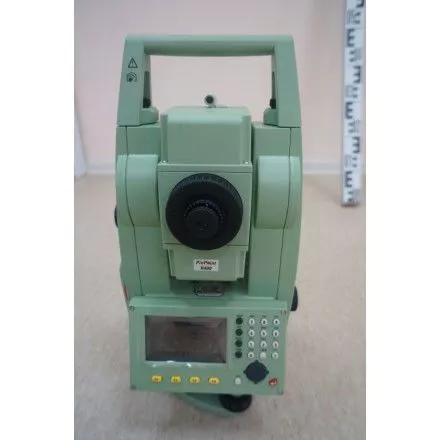
Description
Sale Includes:<br />
1ea Leica TCR-803 Ultra Long Range Reflectorless 3” Total Station<br />
2ea New GEB 121 Batteries<br />
1ea Charger<br />
1ea Hard Shell case<br />
1ea Owners Manual<br />
1ea Rain Cover<br />
1ea Lens Hood<br />
Leica TCR803 Power R1000 SPECIFICATIONS:<br />
The Leica 800 series has some impressive features for an affordable price! With an impressive 1000m reflectorless range, it suits most people's needs! With the large internal memory it is perfect for stake-out tasks. Other handy features include laser plummet and endless drives.<br />
On-Board Software:<br />
Surveying & Orientation - Unlimited number of points supported. Set-up station and set orientation<br />
Free Station - Set up your instrument anywhere and calculate station coordinates, elevation and Hz circle orientation.<br />
Stake Out - Points can be staked out from manually entered data or uploaded from instrument memory. 3D stake out elements calculated using the point coordinates and the station data.<br />
Reference Line & Arc - For setting-out or checking points along a defined line or arc.<br />
Reference Grid - For setting out a grid relative to a reference line. Just enter chainage, increment in length and cross direction<br />
COGO Routines - Coordinate Geometry offers a wide range of calculation functions. These include inverse, traverse, intersections using combinations of bearings, distances or lines, offset calculations and line extensions.<br />
Area & Volume - This program calculates the area, volume and perimeter of plan and slope surfaces. The points can be measured, entered manually or selected from the instruments memory.<br />
Hidden Point - Easily measure points that are not visible using a hidden point rod. The length of the rod and the spacing between the two reflectors is configurable. The rod can be held at any angle when measured and the program calculates the hidden point as if it were observed directly.
- Total station
- surveying equipment
- theodolites
- gnss system
- surveying instrument
Production Capacity:
Not informed
Delivery Timeframe:
Not informed
Incoterms:
Not informedPackaging Details:
Original Packaging
More about
Surveying Parts
50-100
Employees
500K - 1M
Sales volume (USD)
40%
% Export sales
Year
Established
Business type
- Distributor / Wholesaler
Keywords
- Surveying instrument
- total station
- leica builder
- theodolites
- gnss system
Contact and location
-
 Hirras ********
-
+62 21********
-
Jakarta Selatan / DKI Jakarta | Indonesia
